It’s out in the world! I mean the world that this map maps –

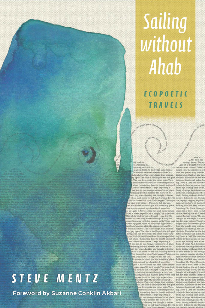
I find it hard to believe, and a little daunting, that this strange fish and passion project poetry book has now embarked on the worldsea, in a beautiful printed package from Fordham University Press.
I hope lots of people will read this (reasonably priced and beautiful paperback) book, and I’m going to do a decent amount of marketing for it, as far as I know how to do that. A podcast with the New Books Network should be forthcoming soon! A reading in South Street Seaport in May! Copies at various places I’m going to talk about various things, from Portland, to Vancouver, to Bremen and Jena in Germany.
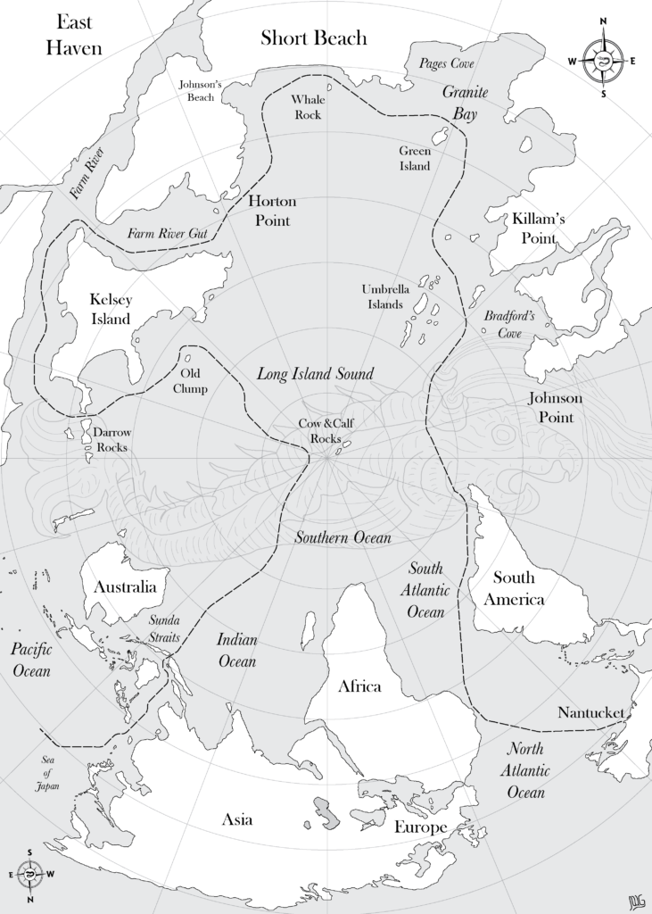
Today I want to introduce the amazing, brilliant map that John Wyatt Greenlee of Surprised Eel Mapping made for the book.

The book entangles an Ahab-free version of the voyage of Melville’s whaleship with my own immersive practice as swimmer and writer along the Connecticut Shoreline. I wanted a map to show that enmeshment, but I didn’t know how. I also wanted a sea monster someplace in the image. So I reached out to John, who I knew mainly as purveyor of eel-facts on Twitter.
We went back and forth about the design. Some early versions were messy. I wanted a dotted line showing the voyage of the Pequod from Nantucket to the Sea of Japan. I also wanted all my local swimming haunts, from Whale Rock to Green Island to the Cow and Calf, a pair of tidal rocks about a mile offshore that mark the far edge of my swimming range. How to fit all those things, plus a sea monster?
John’s two genius innovations were, first, inverting the globe, and, second, centering the Cow and Calf.
The inverted globe disorients, and reminds us of how much the convention of “north is up” organizes our view of the world. The continental shapes remain familiar, but updside-down, with Africa and Asia at the center, North America mostly off the page, and the voyage of the Pequod snaking its way through both sides.
The upper half of the map interposes my local coastline of Short Beach, including Johnson’s Beach, to which I walk my dogs every morning, my swimming haunts of Whale Rock and Green Island, plus other local landmarks within Long Island Sound. It’s my local wonderworld, and if you come visit – just a few miles east of New Haven! – I’ll be happy to take you for a swim to any of these places.
The Cow and Calf Rocks occupy the center of the map. They are a pair of rocks that pose some danger to navigation and also, at a mile off shore, represent a good long swim. A few times over the years in late summer we’ve organized a neighborhood swim race there and back, with kayak accompaniment. They are the center of the map and the edge of this world.
If you look closely across the map’s watery core, you’ll see the trace outlines of a vast fish-monster. John modelled this creature from the drawings on an early modern map that Rachel Carson used as the endpapers for the first American edition of The Sea Around Us (1951). (Carson got her images from Robert Dudley’s Dell’Arcano del Mare, an extraordinary atlas made in Florence in 1645-46 by the exiled illegitimate son of the Earl of Leicester.)
So – an inverted map of the world’s lands and seas, a local portrait of my home waters, a ghostly fish floating across the watery center, all tied together by the Cow and Calf.
What I love most about collaboration are the moments in which someone else’s work reveals back to you something you were trying to express but could not quite work out. John’s map unlocks and visualizes one of the key features of Sailing without Ahab, that the waters we swim in and sail on contain both the local and the global, entwined together, reflecting and in tension with each other. I’m so grateful to be able to have the map in the book!